Now that you have collected GIS data, what can you do with it?
Origin Design worked with the City of Peosta, Iowa to answer that question. The project included a three-phase approach to utilize GIS data for the City’s stormwater projects.
Phase I
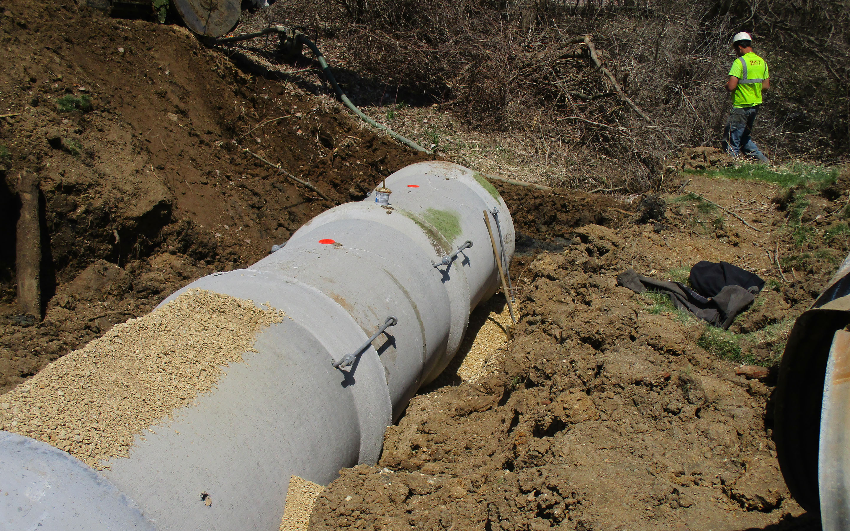
Phase I of the project included the asset inventory, data collection, and GIS database management for all stormwater pipes and structures within city limits. During this phase, data related to location, size, material, and rim and invert elevation is collected and stored in a GIS database. For municipalities with existing GIS databases, Phase I may incorporate updates to the database or the municipality may move directly to Phase II.
Phase II
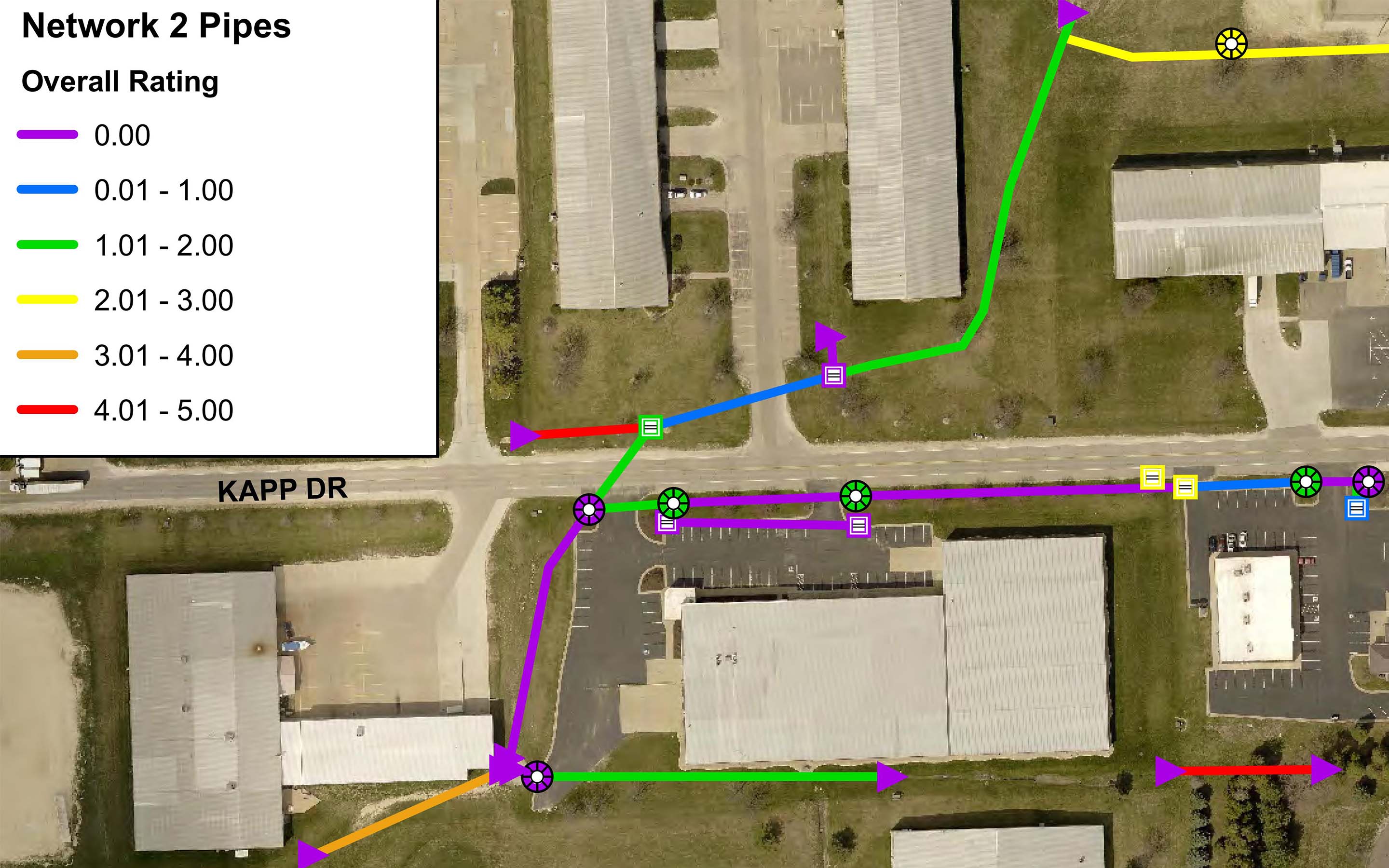
Phase II is the analysis phase of the project, consisting of pipe and structure condition assessments and stormwater system modeling. Condition assessments are performed for each pipe and structure in the system. Pipe assessments involve videos and reports for each pipe, resulting in a rating which designates a recommended replacement timeline (e.g., 0-1 years, > 20 years). Stormwater structures are assessed in a similar way, but with photos instead of videos.
The next step is to import the GIS data collected in Phase I into a stormwater model. Most modeling software coordinates well with GIS data files, making it easy to build a system network ready for analysis. The analysis can look at several different storm events for various types of designs, such as roadway design, water quality design, detention, and more. The model is built either for current land use, future anticipated growth, or both. Once the network, storm event, and land use are ready, the model is run and calibrated using many known factors, including locations of known flooding provided by residents or the City’s Public Works Department. The model is able to determine which pipes or structures are undersized and where flooding is occurring for existing and future conditions.
Phase III
Phase III offers solutions to the issues uncovered in Phase II. The data obtained during the condition assessment is used to list and prioritize all pipes and structures in the analysis area for repair or replacement. With input from the City, prioritization is based on criteria such as the condition ratings, flooding locations, undersized pipes, location in relation to other pipes with poor ratings, proximity to future projects, etc.
The next step in Phase III is incorporating this information into the Capital Improvement Plan (CIP). The plan includes the pipes and stormwater structures requiring repair or replacement in the near future, as determined during the prioritization stage. Repair or replacement options may consist of trenchless lining, spot repair, or full replacement. The CIP will also use the model developed in Phase II to determine which pipes need to be upsized for existing or future land use or identify areas that may benefit from detention. The goal is to find the most economical solution that also protects residents and the environment. In addition, the CIP may include more programmatic changes, such as the implementation or updates of stormwater ordinances, implementation of stream buffer regulations for water quality, or suggestions for cities to purchase inundated parcels to create wetlands or natural areas which can be used for water quality improvement, detention, or educational experiences for students or residents.
To come full circle, the results from Phases II and III can be added back into the GIS database. From the condition assessment, the condition ratings can be added to the database so it can easily be queried to establish how many pipes need to be replaced in the next 5 years. Flow rates or undersized pipes can also be noted in the GIS database, based on results of the model. The photos, videos, and reports can be linked to each pipe or structure so any city employee can click on a pipe, see the rating, and bring up the inspection report or video. This is helpful for instances in which a resident call and complains about flooding at their house. Someone at the City can quickly find the pipe in front of the house and may discover that the pipe has roots growing into it which block flow, or that the model shows the pipe is undersized. The City can cut the roots out of the pipe, make a note in GIS, and monitor the area during the next storm to ensure the issue has been resolved. If the pipe was undersized, the city can check if, or when, the pipe is slated to be upsized.
The repair or replacement timelines determined during Phase III prioritization can be added to GIS for a visual reminder. GIS can also be used to create exhibits for the CIP, as well as for materials for presentations or brochures for the public. As pipes or structures are replaced or repaired, the GIS database can be updated to show the new sizes or materials, as well as the install date. That way, the city can be sure their system map is up to date to make it easier for maintenance crews, assist with NPDES permitting, better serve residents, and more.